If a project is listed on the Portal, we do our best to realize outcomes related to that project during our day-to-day. Sometimes, in chasing down one lead, we come across something significant enough that we just have to share it.
Peter Findlay and the University of Waterloo Geospatial Centre
In the 1970s, Peter Findlay was brought on by Ontario government archaeologist Bill Fox to transcribe the vegetation notes from log books of 19th century land surveyors onto county maps. Findlay also recorded notes about First Nations sites identified by the surveyors. Decades later, London archaeologist Shari Prowse together with the researchers from the University of Waterloo digitized many of these maps.
Covering most of SW Ontario, the Findlay Maps are accessible from the University of Waterloo Geospatial Centre. Middlesex and Bruce Counties will also be added shortly after queries by the Research Portal to Shari Prowse.
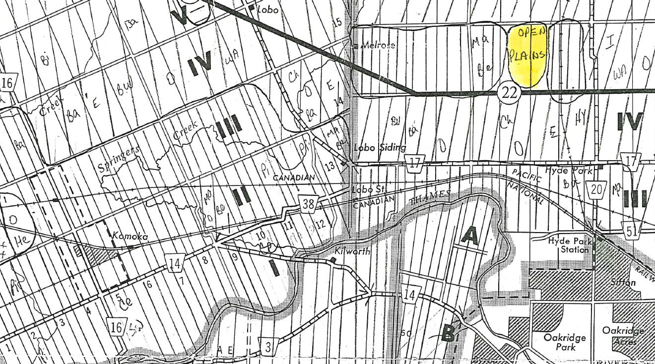
The Findlay Maps represent historical vegetation, soil and First Nations notations from 19th century land surveyor log books on county maps of southwestern Ontario. The maps identify swamps, dominant forest and stands of trees based on lot and concession. The London archaeologist who commissioned the maps, Bill Fox, was interesting in correlations between vegetation types and archaeological site potential.
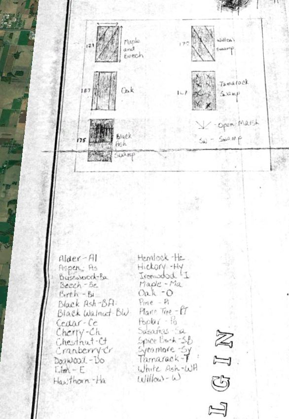
The Findlay Maps Legend
What made the notes so useful, was that 19th century surveyors recorded tree stands for a booming forest industry. Pine in particular, was in heavy demand in both British and American markets. Local governments used the surveyors' notes to support their lucrative timber licensing system (see works by J. David Wood for more information about early settler land-use). Individual surveyors also noted Indigenous land-use including agricultural fields and cemeteries. Bill Fox, was interested in how these early vegetation references corresponded with archaeological sites. Pine, for example, is suited to elevated, drier soils typical of the knolls and ridges commonly associated with archaeological site potential. This possible correlation, together with the Indigenous land-use notations, made surveyor notes a valuable resource for archaeological investigations.
When the Findlay Maps were first drafted in the 1970s, the London Archaeological Office of the Ministry of Culture, Tourism and Recreation was still in its infancy. As commercial archaeology in SW Ontario expanded during the 1980s and 90s, the London office became a hub for information and artifacts. The Findlay Maps, were easily accessible during this period as the London office maintained an open door policy for archaeologists. The 2000s signaled the beginning of a period of introspection for the provincial archaeological division, their London office moved to Highbury Avenue, the doors no longer as open. Simultaneously, new geomatics technologies, like GPS and GIS, were becoming more commonplace. An efficient Stage 1 Background Study no longer included a visit to the London office and the Findlay Maps were largely forgotten. Almost twenty years later, the current resident London archaeologist, Shari Prowse has coordinated with University of Waterloo researchers to digitize these important resources. Easily accessible once again, the Findlay Maps should return to common usage during archaeological background studies.
About the Research Portal
A means to connect researchers and communities and to disseminate the results of their collaboration.